Monday, June 28, 2010

Kakadu to Darwin


28 June - Kakadu to Darwin

The Top End really does have just two seasons. The HOT and wet and the HOT and dry. Temperatures inside our van are as high as 40C during the day, dropping to the mid twenties at night. It is a fairly dry heat but still far from comfortable. We’ve camped in the bush a couple of nights in the national park. The heat is bearable by sunset, but the mossies are something else! Just on sunset and sunrise it is almost impossible to go outside the van. Swarms of mossies gather on the screens, lined up as if at a buffet!

That said, Kakadu is a spectacular wilderness. Rugged escarpments rise from primeval green swamps, alive with birds, fish and, of course, crocs! We took a cruise on Yellow Water, part of the South Alligator River and spotted hundreds of birds and a half a dozen crocs. They were estuarine or salt water crocodiles. These monsters grow to more than 6 metres and weigh more than 1000 kg. Almost hunted to the point of extinction up to 1970, they were fully protected in 1974. Since then, they have multiplied and extended their range.

Aboriginal art galleries abound in the northern parts of the park. Some of the work is reputed to be more than 5000 years old. Interesting as it is, the actual age seems somewhat questionable. Practice amongst traditional owners in this area is to either paint over previous pictures or add to or maintain them. Realistically, this may not be too different from European art restoration practices, but it makes it difficult to accept these as truly original ancient works.

Not having visited Darwin before, we have been more than a little taken aback by the city. No more the rough frontier town, a modern, well laid-out and busy city greeted us.

Cyclone Tracy in 1974 was the second destruction visited upon Darwin, but it probably has done more to build the modern city of today than the first, the Japanese air raids that began on 19 February, 1942.

In 1974, Darwin was a city of more than 44,000 people. After the cyclone, the population was reduced to just a little above 10,000. The city was almost totally destroyed by Tracy, but its spirit was quickly regenerated as the new city grew. Today, virtually everything is new and fairly well planned. Large expanses of green belt, public parks and reserves separate the new suburbs that have developed well beyond the boundaries of the old city. The city centre is vibrant. In addition to the usual array of chain stores, Darwin has capitalised on its climate with many street side restaurants and bars. A US warship was in port today, so the town was really ‘jumping’.

!942 has never been forgotten here, though. People are very aware of just how isolated they still are and how clearly this was demonstrated on 19 February 1942, when over 100 Japanese planes attacked the city. Ships crowded into the harbour were the main targets, along with the RAAF and US bases. At the time of the attack, only 10 US P40 fighters were in the city and they were there only by chance. All 10 were lost in the initial attack. While the city was not damaged anywhere near as badly as in the 1974 cyclone, the fear of further Japanese attacks saw the city virtually abandoned by civilians. Sixty-three further attacks did occur as the Japanese tried to destroy bases from which they could be attacked as they pushed south into New Guinea.

Friday, June 25, 2010

Katherine & Kakadu


After a couple of days at Katherine Gorge, paying outrageous camp fees for very ordinary facilities, we are back in the bush a km or so off the road into Kakadu, at a spot called Harriet Creek. As usual, there are other campers here, with their infernal generators drowning out the birds and the whisper of the soft bush breeze is just enough to get us comfortable in +30 C temperatures. Most of the other ‘wagons’ in this camp are circled with their doors opening into the centre. We have faced the other way with our door to the bush, so at least we get some sense of “wild” camping!

Much to our disappointment, the gorge was closed to canoes because of the danger of crocodiles. There was a late wet season this year so the water levels are still high enough to harbour salt water crocs. So with the canoe strapped tightly to the roof where it has been for some weeks now, we jumped on a river cruise with all the other tourists. The gorge was spectacular, with towering cliffs sheer to the water line. In the morning, we had walked to the top of the escarpment and looked down on the gorge. From that far away, it looked splendid in its isolation. Up close from the cruise boat, it was crawling with people. Hundreds of them! Not a lot of serenity here! There were, however, a few fresh water crocodiles sunning themselves on the water’s edge. They are supposed to be harmless, but at more than two metres in length, the ones we saw could give you a nasty mauling!


Katherine itself is a large town by Territory standards, more than 10,000 people. When we passed through town this morning, it must have been nudging 15,000 with all the caravans, campers and tour buses. So even with the buzz of the generators, our camp for tonight gives us a greater sense of the “Outback“ than we have experienced the last few days.


24 June - Kakadu National Park

Our poor little van had a serious ‘shake-down’ cruise today on the way into Gunlom Falls at the south end of the national park. Forty kilometres of bone-shaking corrugations in and another forty out really sorted out any loose screws. Except for the microwave that almost wriggled out of its slot and some wires that disconnected, all was ok in the end. Once the coating of bull dust was removed from every surface, we were back to normal.

Despite the horror road, the trip was well worthwhile. After what was described in the guide books as a ‘strenuous climb’, we made it to the beautiful upper pools of the falls. The falls themselves are nothing too spectacular, but the view from the cool, crystal clear pools was breathtaking.

Sunday, June 20, 2010

Towards the Top End

20 June - Newcastle Waters to Mataranka

Our camping area by the highway last night was the most crowded we have experienced to date. We were just able to squeeze in between a van and a camper with inches to spare. Ridiculous when you consider how much space is available in the great nothingness that is the Northern Territory! Campers are generally good about keeping to the designated areas to bush camp, but if their numbers keep growing as they are, it won’t be too long before the mostly mild -mannered grey nomads break out and the hundreds of nice spots just off the highways all over remote and rural Australia are just taken over by frustrated campers.

Old Newcastle Waters is just off the highway, north of our camp site. It’s a rusting, corrugated iron ghost town today. The ruins of the old pub and shop are much as they were when the businesses closed up 30-40 years ago.

Further up the road, at Daly Waters, the pub still operates, drawing in the tourists. But, for us, the real thrill was the deserted WWII Airfield just outside town. We were able to drive up the deserted runway where Spitfires and B17 bombers landed in their hundreds, transiting to the front in the Pacific. Nothing has been done to the complex since its heyday. The original markings are still discernable on the runway, the bush has reclaimed some of the out buildings and pieces of wrecked planes struggle with vines and scrub. The main hanger is still intact, housing a few simple information boards about the strip’s wartime service. All this is much more interesting to explore, than the ‘restored history’ that most of these places eventually become.

Mataranka is our first caravan park since entering the NT. Time to do some washing and have a shower. While the washing was drying (which takes about 10 minutes in this sun and wind!) we headed off to the thermal springs for a swim. An oasis of cabbage tree palms greeted us, surrounding crystal clear pools of warm, 34C water. Fantastic!

Neither of us have read the book, but “We of the Never Never” was set in this area and the recreation of the original Elsey Station Homestead built for the movie is an excellent reminder of just how primitive life was in this part of the country up to the 1950s.

Mt Isa to NT


17 June - Mt Isa

The Kalkadoon are the traditional owners of the lands around Mt Isa. They have walked these lands for thousands of years and they still do today. It is almost as though the city, mines, roads and all the other trappings of western civilization don’t exist for many of the indigenous people of Mt Isa. Groups of kids (not in school), families, old couples and assorted combinations of all of the above, drift across the urban landscape as though it’s still just the same scrubby, rocky and dusty world their ancestors knew.

The non-indigenous community, on the other hand, is well connected with all the trappings of their modern city. Supermarkets, fast food franchises and the usual array of government and private offices are all here and operate as they do in any other Australian town or city.

Two worlds, two peoples, living in the same environment and never really connecting. Mostly they don’t even seem to see each other at all! Parallel universes?

Sure, there are a few indigenous families that have crossed that divide, but most of these, from our observations, seem to be ‘outsiders’ themselves. They are Coastal People or Islanders who have moved here for work, just like everybody else.

The mine dominates the city. Physically and economically, it is the biggest thing around, the very reason for Mt Isa’s existence. Copper, lead, silver and zinc have been mined here since the 1920s. ‘The Isa” is Queensland’s largest inland city and one of Australia’s most isolated. Unlike Birdsville, though, another isolated area, where we paid $2 for two potatoes!!!!, the cost of food and fuel supplied by the major chains isn’t too bad. Sadly, booze is outrageous! $56 for a carton of Tooheys stubbies at one place today. Even dedicated beer drinkers such as ourselves baulked at that.

One of our nieces (our favourite of course!) is the Deputy Principal of one of the Stare Schools here, so we have had another great couple of days catching up with family whom we don’t see all that often. - Thanks Nicole!


18 June - Barkly Highway, 120 km west of Avon Downs, NT

Crossing the Northern Territory border 12km west of Camooweal today, we belted off across the alarmingly flat plains of the Barkly Tablelands. The speed limit on the NT side of the border is 130 km per hr. We cruised along at our usual 95 kph.

Camooweal is nothing more than a pub and a petrol station between Mt Isa and the junction of the Barkly Highway and the Stuart Highway, 460 kms west, known as the Three Ways. From there, you can go south to Alice Springs and Adelaide, north to Darwin or east to Mt Isa and, eventually, Townsville.

The mile posts on the NT side of the border had us stumped for a while. SH 460 km? Then we got it. Stuart Highway 460 km. Nothing in between!

So here we are. Just short of the Three Ways. Only a “short” 200 kms of nothingness to go.

Sunset here is just as spectacular as the western sunsets from the Gulf. Here, the bush is the ocean and it goes on just as far. The red glow of the post-sunset is our favourite time. The glow silhouettes the few trees that string out on the horizon and the many vans and tents of our fellow campers become way more attractive in this after-glow than in the harsh light of the late afternoon. Aside from some spectacular flatness, today’s travels were fairly uneventful. It could then be a good time to describe the ‘grey nomad’ bush camp.

In the tradition of the drovers when cattle was king and the swaggies of the depression, modern nomads gather every night at some of the same creek crossings or bore holes in bush camps. All types of vehicles, from beat-up little Toyota and Nissan vans, young (non-nomad) travellers sleeping in cars, to enormous townhouses on wheels, are pulled up around us tonight amongst the low scrub and seasonally plentiful grasses of the Barkly Tablelands. This is a big rest area. Thirty to forty campers at present and more are pulling in as we speak.

There is an etiquette in these camps which makes them safe and generally pleasant places to stay. Noise is kept to a minimum, even in those camps where there are children - yes children! A campers few have generators humming. These folk are frowned upon by us purists who live off open fires, our batteries or solar panels.

On arrival, one must greet one’s neighbours and, in some cases, share a beer or two. The more gregarious of the group actually do a ‘meet and greet’ around the whole camp in an almost proprietorial manner.

‘Lights out’ is generally an hour or so after sunset. By that time, the kids have run out of energy and the older folk have nodded off. We are, however, the exception. After ‘lights out’, we are just starting our cooking, prior to watching a movie or two from our extensive DVD library.

By the time we get going in the morning, however, we are generally the only van still in camp! So, we guess, it all pans out.


19 June - Newcastle Waters

Our first full day of travelling in the NT has been a bit of an eye-opener in a couple of ways.

Distances are epic! Distance markers are often in the hundreds of kms, to destinations that may be just a highway junction or a deserted Roadhouse. Locations rather than towns. We have driven through western Queensland and western New South Wales, where towns may be 100 kms apart, but not much more. Here, the horizon is so far off we are sure we can see the curvature of the earth! Roads are excellent and the light traffic makes for safe travel, even with the speed limit at 130 kph. (Not that we travel at that speed, as the van begins to sway alarmingly over 100kph!)

The state of some of the towns and communities has been the second eye-opener. The most charitable thing that can be said for Tennant Creek is that it has a toilet dump point where we could empty our porta-potti. The least charitable is that we have seen far cleaner towns in the poorest areas of Morocco! A couple of hundred kms up the highway, the small community of Elliott was even worse. We had flirted with the idea of camping there for the night. Slowing down even seemed risky! The few houses that weren’t totally wrecked were enclosed in secure compounds with barbed wire-topped fences.

It’s been very windy the last couple of days. Lucky we were driving with the wind. At $1.70 a litre for fuel, courtesy of Camooweal, a strong headwind could have cost us a fortune! Most other years, we would have been enveloped in a serious dust storm by now, but after two good seasons, the country is knee-deep in grass and, as we go further north, the gold of the dry savannah grasses has started to take on the tropical green hue that we left back on the North Queensland coast.

Monday, June 14, 2010

Savannah Lands


14 June - Croydon, Normanton, Karumba

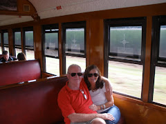
The Gulflander railmotor runs from Croydon to Normanton along a track laid in 1889 on steel sleepers, most of which are still in place today. This isolated bit of track exists only to serve the train buffs and tourists who travel in the nicely restored train on various excursions through the flat savannah between the now tiny towns of Normanton and Croydon.


One of the motels in Karumba is called the 'End of the Road'. That it most certainly is!

You know you are at the end of the road when:
-The Courier Mail costs $3.95 and is only available 2 days after publication;
-Brahminy Kites hunt in the main street;
-Self-contained cabins are Stratco sheds with air conditioning;
-Kangaroos actually do hop up the main street;
-Every street, except the one you came in to town on, leads to a dead end;
-There are Corella feathers in the gutter outside the Café advertising the special of the day as “Chicken et Funghi Fettucine“.

For many of our jolly fellow campers, the road begins in Victoria. Every year, they drag their vans and boats the 2000 plus kms here to spend the winter. They all know each other, staying at the same places all the way up here and back. Together.

Karumba is a real frontier town. There are building and other council regulations and some people abide by them, but much of the town has that 'just threw this up for the season' look about it. Fishing is, of course, the big industry here. Huge trawlers work out of the port, fishing and prawning in the Gulf. Consequently, seafood here is fresh and cheap. Fresh-cooked Gulf prawns, just off the boat, $15 a kilo. There is also a live cattle export port and a large, minerals-loading facility. Tourism can't be forgotten either. The three large caravan parks and several motels are fairly full now, but will be packed to the gunnels in a few weeks as “The Season“ kicks in.

Situated on the western side of Cape York, this is one of the few towns in Queensland that has a western sunset, so this afternoon we are off to the local tavern, called, you guessed it, the Sunset Tavern, to witness yet another brilliant setting of the sun. It’s one of our weaknesses - just can’t get enough of them. Sunrise, now, is another thing altogether. One of our party has only rarely seen a sunrise, and then, only under duress… or coming home VERY late.

As we were in drastic need of a laundry, we have spent a full day and a half in beautiful down town Karumba - more than enough time to see all there is to see, do our washing, even get in a little fishing.

Heading away from the coast, we will have to complete a lot more kilometres between towns. Over the next couple of days, we'll take the long trek south to Mt Isa, before heading west into the Northern Territory.

Saturday, June 12, 2010

Cape and Gulf

June 9 -Cairns to Mossman

Larger coastal country towns like Ingham and Innisfail have grown significantly in the past 20 years. Perhaps not in absolute population, but in services. Innisfail, for example, has suffered recent cyclones and floods to be reborn (yet again!) as a classic Art Déco town. A previous cyclone, sometime in the 1930s, totally wiped out the town and it was rebuilt in the style of the day. Funds flowing into the town on the heels of the most recent disasters have allowed major renovation work to be completed on these classic buildings.

Further north, Cairns is yet another tourist miracle. When we visited her first in the early 1970s, it was a quaint country town. Now, with a population around 150,000, it is one of Australia’s main tourist destinations. And it’s the Barrier Reef and the Tropical Rainforests that brings them, so we joined the Kiwis, European Backpackers, a few Yanks and assorted Asians for the mandatory reef trip and the Kuranda SkyRail and Railway ‘Experience’. Both were fine, although expensive.


The further into the tropics we go, the slower life becomes. Even in ‘winter’, people stroll with what we call the Asian shuffle. In Sydney, Melbourne or even Brisbane they would be trampled to death in the streets.

Tourism here is managed just as slickly as anywhere else we have seen, except perhaps for Vietnam, where they have to deal with enormous chaos and traffic as well, but still make it all happen! Some places, Port Douglas for example, take tourism to new heights. Resorts and golf courses attract Presidents and Pop Stars. Yet another country town made good, it is now Noosa on steroids. A quick drive through was all we could cope with, or afford.

Tonight in Mossman, we are back among the cane fields. Mossman retains its country atmosphere, despite the new housing estates on the town’s fringes, populated by commuters from Port Douglas, some 12 kms away. Speaking of cane fields, even we native Queenslanders forget just how extensive this industry is. From virtually the northern suburbs of Brisbane, the rich green fields stretch for 1500 kms to just about here at Mossman. With sugar prices the highest they have been for more than 30 years and the mining boom, it’s all happening in the north! From here north, it’s some cattle, but mostly tropical jungle for the almost 1000 kms to the Cape. We had planned to head north to Cooktown from here, but it is booked out for The Cooktown Discovery Festival for the whole long weekend, so we’ll head to Cape Tribulation tomorrow for a day trip and then to the Tablelands where things will be quieter. Afraid Cooktown will have to wait for us.


10 June - Cape Tribulation


Crossing the Daintree River on the old cable car ferry was once an adventurous pursuit. These days, good roads run up the coast through the Daintree National Park to Cape Tribulation and this, once-isolated, ‘wilderness’ is easily accessible in the smallest of family cars. Dense tropical jungle fringing coconut palm-lined beaches gives the whole area a South Pacific feel, but the hordes of tourists flooding from mini buses at every turn detract a little from the tropical wilderness ‘vibe’. These aren’t grey nomads either! Young backpackers from all points of the compass seem to have driven the nomads further west. So tomorrow we’ll join them, making the climb up the range to the Atherton Tablelands.


12 June - Ravenshoe to Gilbert River

Ravenshoe’s old railway yards are, today, the base for the Ravenshoe Heritage Railway. Members of this all- volunteer group of steam rail enthusiasts have restored an old 1924 Ipswich-built locomotive that spent more than 40 years in a local park. Every Sunday and public holiday the old “Capella” chugs off with a couple of carriages of punters for the 16 km round trip to xxxxxxx. To supplement their treasury, the good folks of the RHR open their grounds to campers. The site was packed to overflowing the afternoon we arrived. But after a bit of crafty van reversing, we managed to find a spot for the night.

What a contrast today. Leaving the tropical lushness of the Atherton Tablelands, we headed off along the Savannah Way towards the ‘Gulf’ - Gulf of Carpentaria. Moving west, the country progressively flattened out to open grassy plains, criss-crossed by the numerous creeks and rivers that carry the wet season floods out to the Gulf. This early in the Dry, and after such a big Wet, the country is knee deep in grass. A good season!

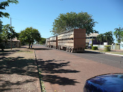
Roads this far north were once all dirt or single lane with dirt verges to allow for passing. These strips are becoming increasingly rare as even the more remote roads are up-graded to two lane. Despite these improvements, great care is required. Murphy’s Law dictates that a three trailer Road Train will always appear on a single lane stretch! These enormous vehicles, greater that 50 mtrs in length, thunder along at 100kph, demanding the full use of the small centre strip of sealed road. As soon as we spot one, in front or behind, we just pull off and stop. Once the dust has settled, it is safe to plod on.

Tonight we are in a bush camp on the Gilbert River about halfway between Georgetown and Normanton. Sounds isolated? Well not quite. As the evening rolls on more and more vans and campers roll in.

Sunday, June 6, 2010

Townsville to Cairns


5 June - Rollingstone to Tully Gorge State Forest

We camped next to a couple of interesting young guys last night who were more than a little down on their luck. Travelling in a seriously ill Excel and down to their last $2 and packet of instant noodles, they started the afternoon rigging up a flying fox , partly to entertain the large crowd of nomads gathered at the fantastic (free) Bushy Parker Park in Rollingstone, just north of Townsville and partly to “earn“ a few much-needed dollars. The failure of this venture was probably indicative of the trail of stumbles and falls that brought these two likely lads to our door. Our neighbours on the other side slipped them food and beer as the evening wore on, but it was we who enjoyed their tales of woe into the evening.

We never exchanged names. One of ‘the boys’ was Canadian/Australian via an Aussie step-father. The other considered himself Irish/Australian or Australian/Irish because he had an Irish fiancée?? They were a couple of real characters who had travelled the world and done all sorts of things, including their last disastrous gig as “chef” and “sous-chef” at … wait for it…the Crown Hotel in Home Hill where they had been sacked after only a couple of days by the ‘mad woman’ owner.

Now, going back a week or so, while camping at Groper Creek , we had dropped into the old Crown Hotel to purchase some supplies. The family that has owned the hotel for decades, the Bonkes, had kids at school when Paul taught there. While acquiring said ‘supplies’ Paul had recontacted the current owner whom he had taught over 30 years ago.. Yep, the one and same ‘mad woman’ owner, well remembered by us, because her name is … Juanita.

Were these knights of the road, ne’er-do-well primary school dropouts or petty criminals on the lam? No. Just a couple of happy-go-lucky, rogue, but highly-qualified Social Workers. Not surprisingly, they were a little rocked by Paul’s views on their sainted profession based on his experiences of their kind in his time in Corrections and Child Safety.

The people you meet! And how closely is the world connected?

Alone again tonight in the tropical hinterland of Tully, we have the beautiful Tully Gorge Forest Park totally to ourselves. Our music is only disturbing the bush turkeys and the millions of banana trees that line the roads to this nicely isolated neck of the woods.

Thursday, June 3, 2010

Burdekin & Townsville Area

28 May - Mackay to Bowen

In the early 1970s, we were regular users of the once notorious Marlborough - Sarina stretch of the Bruce Highway between Rockhampton and Mackay. At that time we lived and worked in the Burdekin district (Home Hill and Ayr). Thirty plus years ago this was a nightmare part of our trip to and from Brisbane. Flooded creeks in summer and in winter, hundreds of kms of unfenced road with roaming beasts, both domesticated and native! In the early 1980s, a new highway was constructed closer to the coast, through St Lawrence. What a difference!

We camped the night at a pleasant Main Roads rest area outside St Lawrence before heading on to Mackay. The drive is no different now from any other part of the Bruce Highway - that is - VERY average as opposed to just plain horrendous.

Queensland provincial cities have ballooned in the past few years. Mackay has always been a major sugar industry service centre. Now, mining services and transport have seen the city boom! Now it’s all traffic, new urban highways, housing estates and bigger ports to feed the hungry ships that line up out to sea, awaiting coal for China. On flights north we have seen scores of orange coloured coal tankers off the coast here and at Gladstone. It’s all happening!

In Mackay we spent a couple of ‘family days’ with Janita’s brother John, his wife Peta and tribe… Lily, Catie and Sophie.

Catie & Lily came with us on a day trip through the never-ending cane fields outside Mackay, to the little town of Finch Hatton and the beautiful gorge nestled in the low tropical ranges to the west of the town. The girls (4 years) did very well, tramping 3 kms to the waterfall without a whimper. Just a lot of chatter!

Today, by-passing the touristy Whitsunday area, we have settled in the luxurious Discovery Caravan Park on the beach at Bowen. We consider ourselves authorities on camping grounds, having stayed in hundreds here and overseas. This is right up there with the best of them. What are the best you might ask? Easy. They are both in Italy. Camping Flaminia in Rome and Camping Michelangelo in Florence. So where is the worst?? Camping ’no name’ near Rabat in Morocco. Ugly!


May 30 - Home Hill to Groper Creek

After 30 years, some do things change.

Thirty years ago, we left the Burdekin after 5 great years teaching at the local High Schools. We came with nothing and left with two small children (ours!), a railway wagon full of goods and chattels, a lot of experiences that influenced the rest of our lives and a few friendships that have remained strong over all those years.

Ayr and Home Hill are North Queensland sugar towns, separated by the river and 12 kms of highway. Despite the ups and downs of the industry, both have prospered to the extent that they would be barely recognisable if we hadn’t had a few visits over the years of our absence. Chain supermarkets, the usual fast food outlets and restored or rebuilt government buildings have, sadly, genericised Ayr, the larger of the pair. Little old Home Hill is still the poor cousin. However, things in our old temporary home town have improved markedly. A well laid out, tree-shaded main street, a nationally known free camping spot in the middle of town and… traffic lights! But most of the progress has been north of the river. No matter. Home Hill still has its nostalgic pull for us. Walking the main street, we are still able to recall the business that operated during our short residence. A closed café here. The old hardware there…..

Catching up with a few old friends was great. Strange as it might seem, despite all the years, the people don’t change.

Tonight we are camped at Groper Creek, the site of many a legendary fishing and crabbing expedition of the past. In our time here, Groper was a squatter village of semi-permanent huts built on unusually high stumps to protect against the regular Burdekin floods. Now there are streets, new houses and a Caravan Park full of grey nomads. How things change!


2 June - Groper Creek to Upper Burdekin Crossing

In the late 1970s, crocodile hunting became a thing of the past in Northern Australia when crocs were declared a protected species. Since then, the habitat range of these less than charming beasties has expanded significantly to as far south as Yeppoon. What has all this to do with camping at Groper Creek one might ask? Well, the warning signs at the boat ramp were more than enough to send one of our fishing party scurrying for her caravan. Despite this loss of fishing ‘person power’, we managed a couple of nice crab meals. Forgotten just how GOOOOOOOOOD fresh, warm crab meat is!

On a rainy morning, we are camped by the Upper Burdekin just outside Charters Towers. Yesterday we visited the historic town of Ravenswood. Gold created this town that, in its heyday, boasted 52 hotels and a population in the thousands. Two of the grander hotels are still operating, but that’s about it for main street Ravenswood.

Mining has resumed here after a break of some decades. The mining companies have done a lot to maintain this historic little town. Several of the remaining buildings have been restored by the companies. A visit to the cemetery gave us some idea of the past size of the town. Burials commenced here in 1872, peaking in the first decade of the 20th century. A quick count put the number of graves at better than 5 times the current town population of 230. Of particular interest was the small Chinese section of the cemetery.


3 June - Charters Towers to TownsvilleRain! But it’s June in the tropics. How can this be?

Our camp by the Burdekin last night was relatively quiet - except for the trains that rattled over the enormous girder bridge that spans this sometimes mighty river. Oh, and the Road Trains that thundered over the nearby road bridge. A ‘sometimes mighty’ river because the Burdekin is mostly a placid stream that meanders from north of Charters Towers to meet the sea at our previous camp site at Groper Creek. When fed by a good tropical wet season, this tranquil stream becomes the original raging torrent!

At our camp site, the river has, in the recent past, reached a height of 22 metres above normal river levels. That’s a lot of water!

In our time at Home Hill we were lucky enough to miss a major flood. And major it would have been in comparison to what could happen now, because in the early 1980’s a dam was built some 80 kms down stream from Charters Towers, providing the north with an enormous water storage capacity and mitigating the flooding further down stream.

Charters Towers is another well preserved reminder of the wealth that Gold bought to the North. Once known as ‘The World’, the ‘Towers’ had scores of pubs and a Stock Exchange. Even today, the main street is lined with substantial 19th century buildings that would not have been out of place in New York, London or Paris at the same time.

We dropped into a small miner’s cottage museum for a bit of history and local colour and found far more than we had bargained for. Chatting with the local character who ran the place would have been experience enough, but when he mentioned that he came from Millmerran, Paul casually said that his grandfather had been a tailor there in the late 1930s /early 1940’s. “Not Jim Ward?” he said… Oh yes indeed! Our host, Alan (Tony) Christensen was even able to tell us Paul’s mother’s name and, with coaching, her older sister’s name as well! Alan is now 82 (looks 70) and still has a school photo of Paul’s mother and sister at home… How’s that for a memory after 70 years? Watch out Pauline!

But … that’s not all! ‘Young’ Alan also once lived at Holland Park, in Crump Street. As the crow flies, less that 500 mtrs from where we have lived for the past 30 years! Who said there were only 6 degrees of separation?