Friday, July 30, 2010

Geraldton to Perth

27 July - Fremantle

This has probably been the biggest break in the blog to date! We do have an excuse. We visited our daughter Elizabeth and her partner Sam in Geraldton and got a bit side-tracked.

Kalbarri is a small beach town at the mouth of the Murchison River. Kalbarri itself is in the throes of a major growth spurt, as are most towns on the Western coast. Tourism is booming, along with mining, and towns like this are riding the wave. Other than the spectacular coastline, beautiful estuary and fantastic fishing, Kalbarri is the stepping-off point for the Kalbarri National Park. Over the millennia, the Murchison has carved deep red gorges into the otherwise flat and seemingly never-ending plains of the WA coast. We did a fantastic 8 km bushwalk through the gorges. It’s rated as a difficult trail, but in the mild weather and with the river fairly low, it was a bit easier than when we did it a few years back. Or are we just fitter?

Geraldton was great fun for us to catch up with Lizzie and Sam and their crazy dogs. We have been here before so most of the local sites were not on our agenda. We put in a bit of serious fishing time, with little success and spent a puzzled afternoon watching Sam play Aussie Rules. We just don’t understand the game, but Sam seemed to do a lot of good things - we think?

A real surprise awaited us just outside Cervantes, about 250km north of Perth. The Pinnacles National Park is an enormous area of re-exposed, eroded limestone seabed, set in yellow sandy soil. In the late afternoon light, the exposed stones looked like a thousand Stonehenges, mixed with drippy sandcastles and demons.

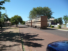
Today, we walked from our caravan park the few kms into Fremantle. The city is, of course, still a major port and industrial centre, but it has been gentrified over the past couple of decades and the container cranes form a backdrop for a very trendy little city centre with street after street of restored 19th century pubs and commercial buildings. One of Australia’s most attractive cities!

As modern cities go, Perth itself is beautiful., set beside the wide estuary of the Swan River and surrounded by parkland. But, as with many cities Australia (and world) wide, it has become a little gentrified - the same shops, the same streetscapes. What must be said for Perth though is that it has fantastic public transport. We are real urban train freaks, no matter where we travel. Perth’s system isn’t the London Underground, but it is efficient, clean and user friendly. What we really love are the free CAT bus services that operate in both Perth City and Fremantle.

Tuesday, July 20, 2010

Coral Coast WA

15 July - 140 kms south of Exmouth

Flies. The scourge of the Australian outdoors. And none as persistent as the sticky little bush fly! Here at yet another WA Rest Stop, they are driving us mad. We even have our special hat-flynets, but they still manage to crawl up under the net and worm their way into your eyes, ears and nose! As the sun sets, we break with our tradition of sipping on a beer outside the van to catch the last light on the red plains and head indoors behind the fly screens.

North-West Cape where Exmouth sits, was probably better known nationally in the 1960s and 70s when the controversy over the giant joint US-Australian communications base was at its height. Thirteen giant towers stand at the top of the cape. Visible from 30 kms off, they were once an important link in the US Navy’s global communications network. Largely obsolete today, they now just serve the Australian Navy’s Indian Ocean communication needs. Cape Range National Park covers much of the cape and it’s this that draws the thousands of tourists that are packed into Exmouth and the few camping grounds inside the park this last week of the WA school holidays.

Coral reefs line the western shores of the cape. Nothing on the scale of the Great Barrier Reef, but far more accessible, with the reefs within swimming distance from many of the beaches. Beautiful clear tropical lagoons are dotted along the 70 odd kms of the Park’s coast line. On shore, the red cliffs and gorges of the Cape Range bring the desert and the sea together. The eastern side of the range is less crowded and accessible only by fairly rough dirt roads. Well worth the drive though! We made the slow climb up the eastern side late in the day and were treated to the colours and shadows of the last of the afternoon light. Not the Grand Canyon, but with the sea as a distant backdrop, mighty impressive none the less.

It might have been the teeming school holiday crowds, but the small beach resort of Coral Bay just south of Exmouth, was a bit too crowded for our liking and we’ve elected to spend another night on the road.


17 July - Quobba Station, 50 Km N of Carnarvon

WA really does stand for WINDY ALL the time. The further south we go, the windier it seems to get. It has blown a gale all day today. Our van is rocking in the strong off shore wind blowing over the desolate coastline just north of Carnarvon. Here, the Outback literally meets the sea. Parallel red dunes roll west from the desert, meeting the white sand dunes of the coast. Quobba Station is a sheep and beef property blessed with an 80 km shore front of rugged red cliffs, shell-littered, sandy beaches and some of the best blow holes around. The owners have branched out and created a caravan/cabin park here and a luxury “Eco-resort” 60 kms further north.

Facilities on Quobba are a bit basic, but the beach front location and the interesting station buildings make it well worth the 10 km of dirt road to get here. We had a wander around the old shearing sheds this morning. It was like walking back into the heady days when Australia ‘rode on the sheep’s back’. The words of “Click Go the Shears” ran through our heads. The original, belt-driven shearer’s stands were still in place, as were the sorting table and the giant wool press. The old shearers’ quarters are now rented out to travellers. Very basic! Just as they were in the 1950s. None of these buildings have been restored. They remain as they were when the last sheep went out the shoot.

We have been collecting shells along the way on this trip. The beach here has hundreds of clam shells - not the giant variety, but still a fairly large shell. The interesting thing about these shells is that the rocks of the red cliffs on the beach have these same shells imbedded in them. Lying on the beach are shells washed ashore today, now lying beside exactly the same variety of shells that were washed ashore on this same beach over a million years ago, now re-exposed as the sea erodes the rocks. We are reminded that Australia is indeed an ancient land!


18 July - Shark Bay

Just a few kilometres west of our beach camp site lies Dirk Hartog Island, named after the first European to arrive on Australian soil. It was 26 October 1616, 152 years before Cook landed on the east coast. Captain Hartog, a Dutchman, inscribed a pewter plate and nailed it to a post to record the event. 81 years later, his countryman William de Vlamingh revisited the site and replaced Hartog’s plate with another, taking the original back to Holland, where it is now on display in the Rijks Museum. Vlamingh’s plate is now in the WA Maritime museum in Fremantle.

One look at the coast line around here and it is clear why the Dutch quickly banged out an inscription and high tailed it back to the East Indies. Wind swept comes quickly to mind, followed immediately by desolate. We haven’t seen a tree higher that 1 metre for 500 kms! Feral goats seem to thrive but even the emus have to carry a packed lunch to survive. However, it must be noted that it has been overcast as well as windy all day today, so our perception has been blighted by the weather. On a better day, we might have regarded it as “the garden spot” of the whole of WA, as the Sundance Kid noted to Butch Cassidy.

Monday, July 12, 2010

The Pilbara


9 July - Eighty Mile Beach

Derby and Broome lie at about the same latitude as Cairns. Northern Australia from Cairns north and west to Broome is often known as the Top End, or Tropical North - an area of fairly constant temperatures with seasons determined by rainfall. The Wet or the Dry. Well, that’s the theory. For the last week, the north west has had pelting rain, floods and road closures!

We were lucky in Broome. We managed to pick up a camping site at Cable Beach due to a cancellation. When we got there, we found out why. The poor sods who had our site in this totally booked-out town were camping in tents and were flooded out.

Broome is very touristy, a bit like Byron Bay with fewer hippies and more indigenous Australians. The town itself had little to offer us. A few pubs, over-priced pearl jewellery shops, plus the usual suspects of clothing and souvenir stores, are of little interest to us. Cable Beach, where we stayed, was the real attraction, with 22kms of white sandy beaches. The patrolled beach, close to the resorts, but a couple of hundred metres from our caravan park, was packed. Camel rides are the thing to do on Cable Beach. So we didn’t, just to be different! Forty or so camels plodding along the beach amongst the 4x4s and “Naturists” choosing to parade their wares, made for a very different beach scene.

The drive from Broome to our beach side caravan park at Eighty Mile Beach was far less interesting than the northern part of the Kimberleys. The flat plains seem to stretch for ever. At one point, we spotted a herd of wild camels strolling along, silhouetted against the steely grey sky. No flash saddles for these descendents of the ’Afghan Camel Trains’ that moved freight through remote Australia more than 100 years ago. Today, these feral herds are the world’s last remaining wild camels.

Eighty Mile Beach is about 350 kms from Broome and 250 kms from Port Hedland and there is nothing in between in either direction. So, to drive up 10 kms of dirt track from the remote highway junction to find hundreds of caravans and tents is a bit of a shock! This is a very popular fishing spot. We’ll try our luck tomorrow, but it’s very different beach fishing to what we are familiar with. The tides here can be as much as 8 metres between high and low, the beach is more than a kilometre wide at low tide and the water is very shallow at high tide.

The number of travellers like us on the road continues to amaze us. No matter where we go, roadhouses, beaches, bush camps, caravan parks or just on the open roads, thousands of nomads, backpackers and, at school holiday time, holidaying families, are hitting the road. We meet people who live in their vans or motor homes. They have no other home. Others regularly abandon their homes in ‘miserable’ cold places like Victoria for the winter and camp at one regular spot for six months every year. Many, like us, are just roaming about.


11 July - 90 kms south of Port Hedland

Ore trains over 7 kms long; tankers lining the horizon; red iron oxide dust covering everything. This is where it is all at. Port Hedland is one of Australia’s largest ports and, along with the coal ports of central Queensland, exports the enormous mineral wealth of the nation. Forty years ago there was nothing on the desolate Pilbara Coast. Today, the ore trains, dragged by eight locomotives, lumber in and out of town 24 hrs a day. Six mineral tankers are loading at the same time on the docks. Further out on the point, work continues around the clock to expand the loading facilities to eight tankers at a time. This is what kept Australia out of the recession over the past year or so.

Other than its significance as the port for the Pilbara mines, Port Hedland has nothing more to recommend it. Everything is red. The dust from the ore stockpiles covers the town. Every roof, every road, all the cars, every surface is red!

The industry supporting the mines and the port draws more than the normal Road Train traffic. Even though it’s Sunday, a truck roars past our camping area every few minutes.

Monday, July 5, 2010

West Kimberleys


3 July - Kimberleys, WA

We have seen a lot of jaw-dropping scenery in our travels. Probably the most impacting was our first sight of the Grand Canyon. The Kimberleys come very close! Rocky escarpments with red, gold and every colour in between, tower over rolling gold and light green valleys dotted with tangled, bulbous boab trees. Lake Argyle, just over the border from the Northern Territory is the largest fresh water lake in Australia. Man-made by damming the Ord River, the lake adds a brilliant blue to the spectrum of colours.

Kununurra and Wyndham are the two main towns of the northern part of the region. Neither have much going for them. Kununurra is by far the larger of the pair. It was created to service the Ord River Irrigation Scheme. Today, a service town is about all it is.

Wyndham today would hardly even be worth the drive, except for the fact that it is one of the ‘must visit’ places on most round Australia travellers’ itinerary, simply because it is WA’s most northern town. The town does have an interesting past, but it is mostly in ruins today. Wyndham Port is far more interesting from this perspective than the newer town a few kms inland. Four or five battered corrugated iron shops are all that is left of a once thriving multi-racial community. Chinese merchants, tailors and market gardeners supported the old port where they gathered after the gold petered out around the turn of the century. Afghan camel herders and local aborigines worked the gardens that fed the town and sailors from South-east Asia. Some of the Chinese families still live in the town, though all that remain of the Afghans is an isolated cemetery.

Friday, July 2, 2010

West to WA

29 June - Litchfield National Park

Great debate rages locally (and beyond) on the relative merits of the two major NT National Parks, Kakadu and Litchfield. In our books, it’s a ’no contest’. Kakadu wins hands down!

It is easy enough to understand why the locals prefer Litchfield. It’s an easy day trip from Darwin, with many accessible swimming holes and good sealed roads. Sure the falls are very nice and probably a cut above those in Kakadu, but the crowds! Hundreds swarmed over Florence Falls and Buley Rockpool swimming holes when we visited today. The car park was packed and the walking paths clogged with nattering children and slow pensioners.

Litchfield has none of the scenic splendour of Kakadu, no Aboriginal Art and no wetlands teeming with wildlife. I’ts not all bad though. The National Park camping area we are in at Wangi Falls is probably the best of its type we have seen. Hot showers, toilets and individual sites, all for $15 a night! Plus we gave ourselves a fair bit of exercise scrambling over some relatively rough trails, a bonus after a fair few days of driving.

30 June 78km West of Kathryn NT

The title of this blog is fairly indicative of some of the places we have been staying. A no name (that we know?) bush camp.

We were here just after 3:00pm. By no means the first arrivals. This place is topical of hundreds, perhaps thousands, of gatherings like this all over Australia tonight.

If we were travelling in Europe, looking for a ‘free camp’ in our motorhome, this is the very place we would avoid like the plague. Gatherings of caravans in open fields with fires going can mean only one thing there. Gypsies. Groups of nomads who have roamed Europe for centuries. We make no judgements on the reality of the reputation of Gypsies. We just know by our own experiences not to camp anywhere near them!

Camp ‘No Name’ in Australia is however somewhere where ‘travellers’ like us instantly feel safe. We know the drill. Toilets over there. Water tanks by the road - treat both with suspicion! Wandering chatty couples some of whom we have camped with further ‘up the track’. The obligatory European backpackers in a Wicked Van. Some guy strumming a guitar. Road Trains thundering past on the highway, still well within hearing distance. Sunset through the trees.

An Australian Gypsy Camp.